

The European Space Agency is launching the first satellite capable of measuring the wind speed on the surface of the Earth from space.
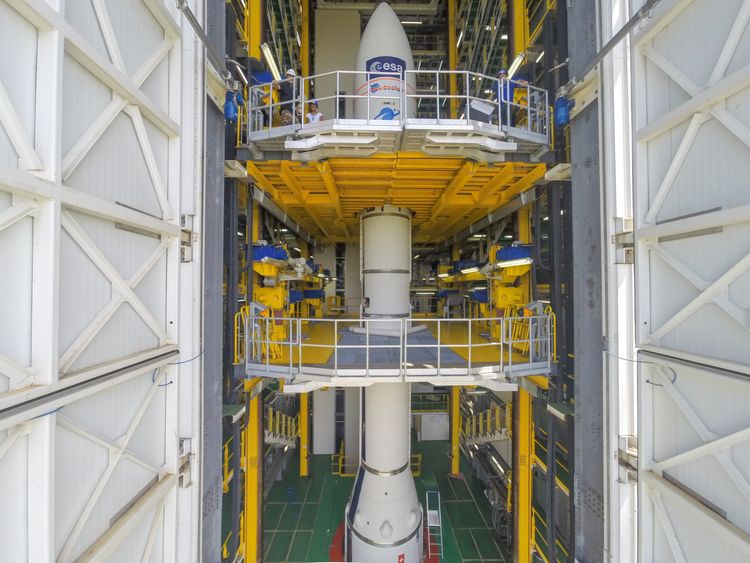
Named Aeolus after the ruler of the winds in Greek mythology, the satellite was built in the UK and will be launched from the ESA facility in Kourour in French Guiana.
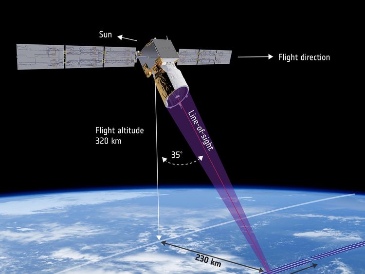
Aeolus is set to dramatically improve weather prediction models by using lasers to measure winds on the surface of Earth and up to 30km into the stratosphere.
It will do this with one of the most sensitive scientific instruments ever put into orbit, a pulsed laser lidar called ALADIN (Atmospheric LAser Doppler INstrument).
Aladin will shoot out powerful laser pulses through the atmosphere and measure the light that scatters back from particles in the wind to detect how it is flowing.
First scheduled to launch in 2007, the ESA mission has been plagued with delays – and the satellite's planned launch on Tuesday was delayed one final time due to adverse weather conditions.
Such unexpected conditions will be more foreseeable once Aeolus is operational, as it is now being launched only a day later to an orbit of 320km (200 miles) on the back of a Vega rocket.
"For one hour and 10 minutes after lift-off, there is no possibility for us to command the satellite – it is purely in the 'hands' of the launcher itself," explained ESA's spacecraft operations manager Juan Pineiro.
When the satellite successfully separates from the rocket and begins flying freely, it will extend its solar arrays and turn towards the Earth, examining the planet and communicating with a network of ground stations across the world.
According to ESA, the first three days of contact with Aeolus will be the most intense for the teams on the ground.
This phase, known as the LEOP period ("launch and early orbit phase"), is critical for satellites as it is when the management teams need to switch on and configure the flight control systems are all working.

"This period is risky," explains Rolf Densing, director of operations. "The satellite is not yet fully 'switched on' yet needs to be protected from the potentially dangerous scenarios that can arise in any complex space operation.
"But with ESOC's expertise on hand, this risk is reduced," Mr Densing added.
"Experts from flight dynamics, operations engineers and specialists in control systems and ground stations will be working together in unison to ensure this unique and important satellite is successfully placed into orbit."
More from ESA
James Cotton, a satellite winds scientist at the Met Office, said: "The Aeolus mission aims to improve the global coverage of wind profile observations, including areas where in situ wind measurements are currently lacking, such as over the oceans, in the tropics and the Southern Hemisphere.
"Within numerical weather prediction, we expect the Aeolus winds to be particularly useful for improving our analysis of the atmospheric state in the tropics, a region where we know the model wind errors are large."
[contf] [contfnew] ![]()
Sky News
[contfnewc] [contfnewc]


