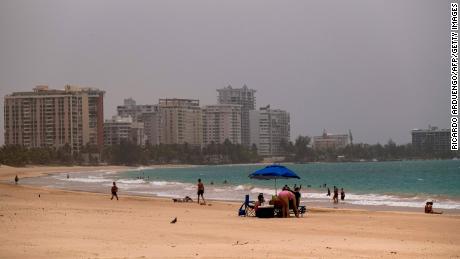
"The Saharan dust will overtake entire states," CNN meteorologist Tyler Mauldin says. "Even southern Illinois and Ohio may get into the mix. That's how far north it could get pulled up." An area of higher pressure over the Southeast will allow the Saharan dust layer to move into much of the Gulf Coast region over the next couple of days.Forecast models show a lighter amount of dust moving into the Gulf Coast states on Thursday morning. This week's more dense concentration, seen in images across the Caribbean, won't move fully into the southern US until later today and into the weekend. Portions of Texas, Louisiana, Alabama and Florida could see milky-looking skies and an enhanced sunset this evening."The main impacts of the Saharan dust will be hazy skies during the day, locally reduced visibility and degraded air quality," the Weather Prediction Center said. "However, this will also make for some very colorful sunrises and sunsets with deeper oranges and reds compared to normal."By Friday and into Saturday, the dense plume will move across all of the southern US. Through the weekend, a thinner amount of dust will advance across much of the eastern US. At the same time, a denser concentration will hang around the Southeast, mainly Alabama, Georgia, and Florida. "Some of this dust will settle to ground level," CNN meteorologist Chad Myers says. "People should monitor their local air quality and possibly limit outdoor exposure."
This Saharan dust plume is historic
"The ongoing Saharan dust outbreak across the tropical Atlantic is by far the most extreme of the MODIS satellite record — our most detailed, continuous record of global dust back to 2002," tweeted Atmospheric Scientist Michael Lowry. "It is definitely historic," Olga Mayol-Bracero, a researcher at the University of Puerto Rico, told CNN Weather. "We knew we were going to be in an extraordinary situation."Many of her colleagues across the Caribbean said they have not seen air quality conditions this bad in their entire careers, she said.Aerosols, measured in PM10, at Mayol-Bracero's research station in northeastern Puerto Rico, have never reached the levels they have seen the past few days. Records at this station go back 15 years.  The dust was so thick in Puerto Rico and across the Caribbean, it darkened the skies and reduced visibility to only a few miles. The Saharan dust plume is nothing new. It is called the Saharan Air Layer or SAL by scientists who study it and its effects on hurricane development. But scientists say this one is historic because of the dense concentration of dust. "While it's normal for Saharan dust to reach the US every hurricane season, this event is unprecedented in thickness and coverage," Mauldin says."Usually by the time dust from the Sahara has traveled this far, much of it has been dispersed and/or deposited to the ocean so that typically this long-range transport to the Americas would involve much lower concentrations," Claire Ryder, NERC Independent Research Fellow at the University of Reading, told CNN Weather.
How the Saharan dust plume got its start
The initial dust outbreak was driven by a few smaller storm systems over central and west Africa. Several of these thunderstorms caused downdrafts and large-scale haRead More – Source
[contf] [contfnew] 
cnn
[contfnewc] [contfnewc]


