

Blizzard warnings stretch from Colorado to Minnesota, and winter storm warnings and advisories encompass a larger area, from Utah into Michigan, the National Weather Service said. Officials urged drivers to be cautious, with states such as South Dakota warning people in some counties to stay off the roads completely. "Really hope this is the last snow storm we'll have to post about this spring," the National Weather Service tweeted. "But … it's worth repeating. Stay safe out there!"The heaviest snow Thursday will fall in western Nebraska, much of South Dakota and much of Minnesota as the system tracks northeast into Canada. Those areas could get 2 feet of snow by Friday morning, with 30 inches possible in places. More than 40,000 utility customers were without power Thursday morning, mainly in Minnesota and South Dakota.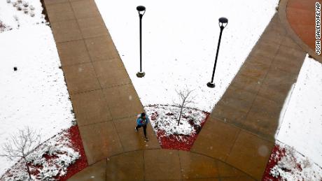
Second bomb cyclone hits the region in 4 weeks
This is the second bomb cyclone to hit the Rockies and Plains in four weeks, and it's delivering a temperature shock to a region that had been enjoying springlike conditions, dropping snow Wednesday in parts of Wyoming, Colorado, South Dakota and Minnesota.CNN STORM TRACKERThe extremely powerful storm produced wind gusts of hurricane strength. The strongest wind gust reported was in Pueblo, Colorado, at 107 mph — the equivalent of sustained winds in a Category 2 hurricane. High winds will continue Thursday. Wind advisories or warnings stretch from Texas and Louisiana north into the Upper Midwest.Four weeks ago, a similarly powerful system dumped heavy snow and rain on some of the same regions, leaving hundreds of millions of dollars in livestock and crop damage in Nebraska alone, largely through flooding. It's rare enough to have one bomb cyclone to form inland, much less two in a month. More typically, bomb cyclones form off the US East Coast as nor'easters.A bomb cyclone is a rapidly strengthening storm that reaches a certain standard in 24 hours. Generally, that criterion is a low pressure that drops 24 millibars (a unit of pressure) in 24 hours.But that benchmark also is based on the storm's latitude, and at Colorado's latitude, this storm needed to drop only around 18 millibars in 24 hours, which it did, CNN meteorologist Brandon Miller said.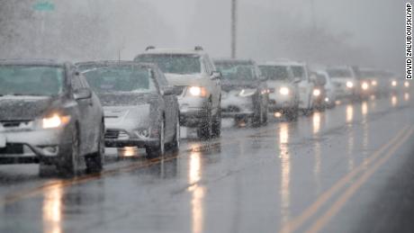
Stay off the roads, drivers are warned
In some states, getting from one point to another will be a nightmare.The National Weather Service office in Nebraska said travel will be almost impossible until Friday morning, using language nearly mirrored by offices throughout the region.In South Dakota, the sheriff's departments of Deuel and Hamlin counties asked people to refrain from driving through the area Thursday as the blizzard shut down parts of interstates. "Roads are becoming impassable. Unless you are experiencing an emergency, please stay off the roads," the National Weather Service said. South Dakota Gov. Kristi Noem ordered state government offices closed Wednesday in 52 counties, and state transportation officials urged people to stay off highways.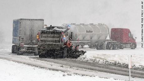 As the storm moved east, authorities reported treacherous travel conditions, flight cancellations and traffic pileups. The Minnesota State Patrol responded to 213 crashes by Wednesday evening. Of those, 33 involved injuries, authorities tweeted.In Colorado, Gov. Jared Polis activated the state's national guard to help stranded motorists.
Temperature plummet precedes flood and fire risks
Earlier this week, Denver had been basking in springlike conditions, with 78 degrees Tuesday, a near-record high for that date.By Wednesday, snow was falling.And the Minneapolis/St. Paul area, which also enjoyed warmth this week, could soon see up to 5 inches of snow. Read More – Source
[contf] [contfnew] ![]()
CNN
[contfnewc] [contfnewc]


